The Trip That Taught Me to Carry a Satellite Beacon
By 2020 I'd done enough trips to think I knew what I was doing. I was older, I was wiser, and for the first time I wasn't showing up with a pack full of nothing but borrowed gear. Then the backcountry reminded me, in the most serious way it ever has, that being prepared is not the same as being ready for everything.
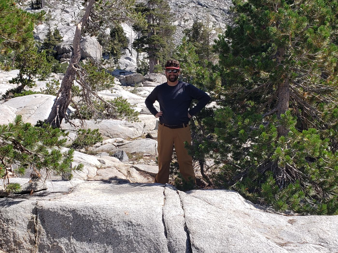
Me, a little older and a little wiser. Still borrowing some things — but finally buying my own.
This is me eight years after my first clueless trip into this same wilderness. I was still borrowing some of my equipment, but by now I'd started chipping away at every lesson the earlier trips had beaten into me — buying my own gear, piece by piece, to fill the gaps. A real sleeping bag. A pad that actually insulated. The slow, satisfying graduation from “making it work” to actually being outfitted for the mountains. I felt like a backpacker now, not a guy tagging along.
It was the height of the pandemic, and it turned out half of California had the same idea I did. Desolation was packed. Trailheads full, permits scarce, people at every lake. The wilderness had never felt so crowded. We had four nights planned and a proper route across the heart of it: Lake Aloha to Lake Gilmore to the Velma Lakes.
Day 1 Leaving Aloha
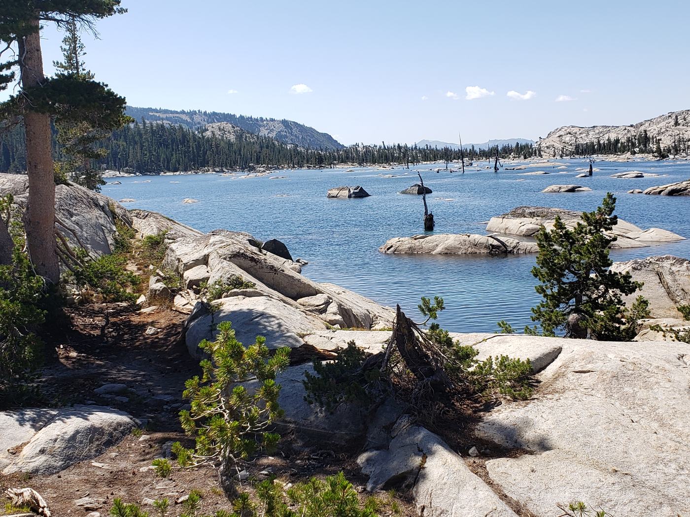
Lake Aloha on our way out — granite islands scattered across the shallows.
We broke camp at Aloha and started the long walk deeper into the range. Aloha is one of those places that doesn't look quite real — a wide, shallow sheet of water with bare granite islands poking up all across it, the whole basin scoured down to rock. You stop, you stare, you take the same photo everyone takes, and you keep moving.
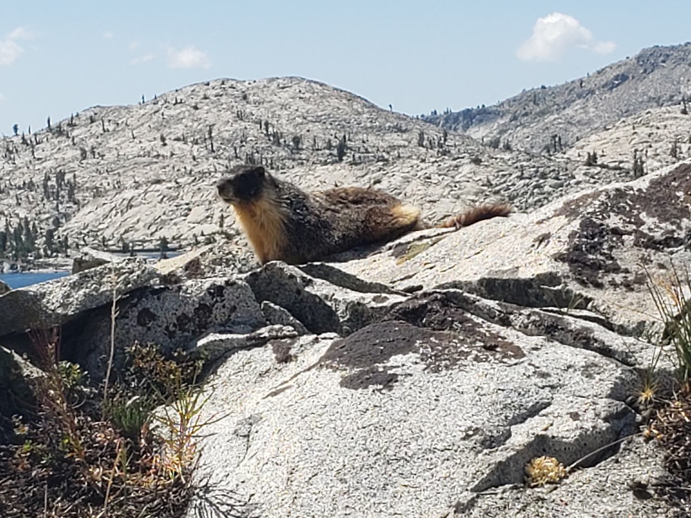
An old “friend.” Years ago, the sound this thing makes at night genuinely scared me.
And then, a marmot — just sitting on a rock like he owned the trail. I have a history with these things. On my very first trips, I'd hear them at night: a sharp, whistling chirp out in the dark, and I had no idea what it was. With no clue what was making the sound, my imagination filled in something much worse. Now I know better. Now a marmot on a boulder is just a friend on the trail, and the only thing he's a threat to is the snacks in your unattended pack. It's a small thing, but it's the whole arc in miniature: the backcountry stops being frightening exactly as fast as you start to understand it.
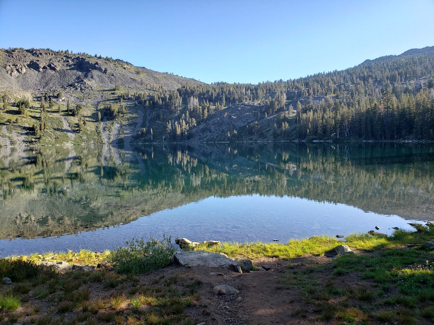
Camp A perfect site at Gilmore
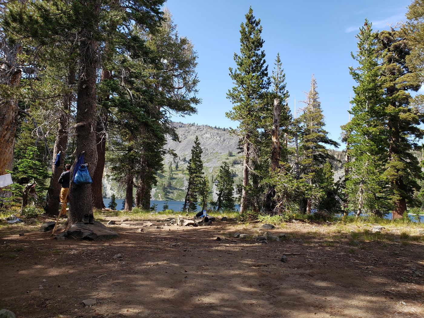
Camp at Gilmore. The kind of site you remember — flat, sheltered, water right there.
We landed one of those campsites you remember for years. Tucked in above Lake Gilmore, flat ground, a little shelter from the wind, water a short walk away. Eight years earlier I'd pitched my tent on the first marginally flat spot I could find and called it good. Now I knew what a good site actually looked like, and finding this one felt like a small victory all its own.
A quiet night at the lake. The crowds thinned, the water went still.
As the light went, the day-trip crowds melted away and the lake went glassy and silent. A quiet night at Gilmore. This is the part of backpacking that never shows up in the gear lists or the trip reports — the long, still evening when there's nothing left to do but sit and watch the sky drain out over the water.
Morning A swim worth the walk
Morning. A view and a swimming hole in the same spot — you don't argue with that.
Morning gave us a view and a swimming hole in the same place, which is the kind of offer you don't turn down. Cold-lake swims have become a non-negotiable ritual on every trip since — nothing resets a tired body like alpine water that makes you gasp. We swam, we dried out on warm granite, and for a little while everything about this trip was going exactly right.
Afternoon A Sierra thunderstorm
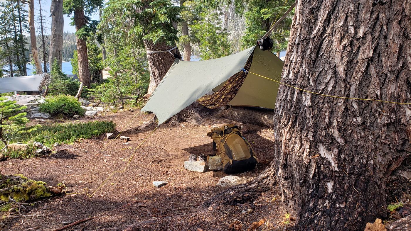
My borrowed rainfly, looking its age. It held — barely — through a surprise storm.
Then the Sierra did its afternoon trick. If you've spent time in these mountains in summer you know the pattern: a bright, blue morning builds into towering clouds, and by mid-afternoon a thunderstorm rolls through out of what felt like nowhere. They come up fast and they come up often. I dove under cover and got my first good look at my rainfly — which, I realized right then, was not in great shape. Because, of course, I'd borrowed it. The seams were tired and the coating was going. But it held. Barely, and only just, it kept the rain off me until the storm blew through. One more entry in the ledger: borrowed gear gets you there, but it's the gear you can actually trust that lets you relax.
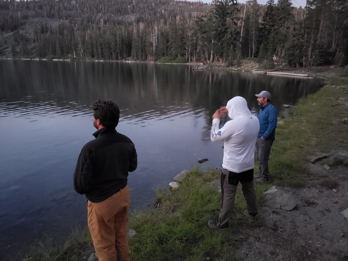
Something's wrong Over Jacks Peak
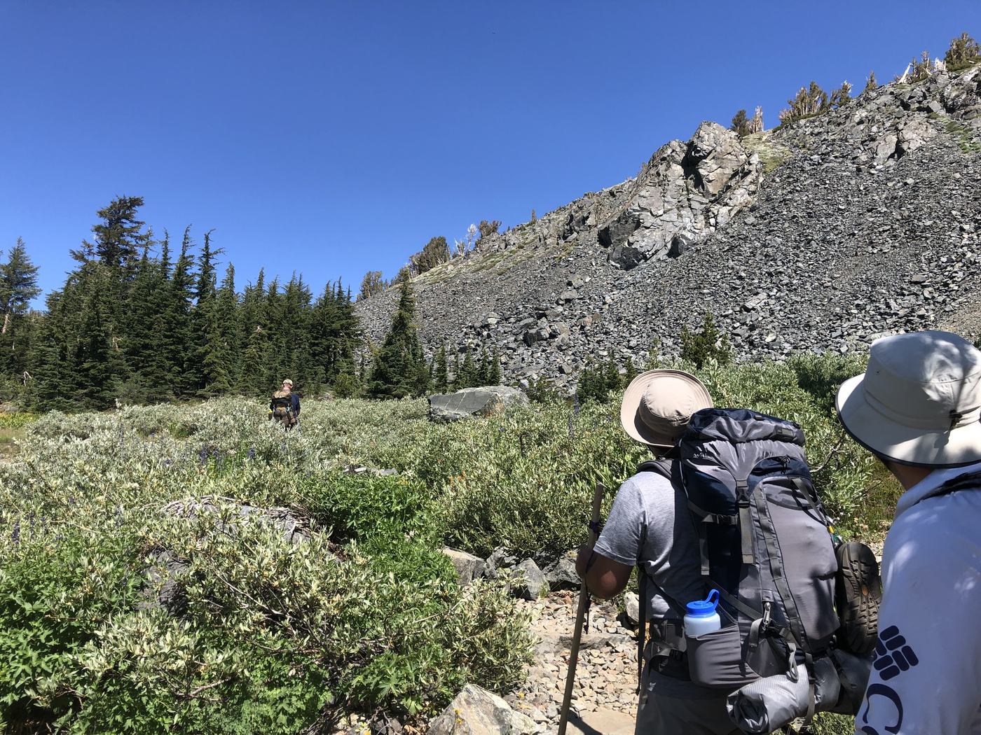
The climb up and over toward Jacks Peak. By now, one of us was already in trouble.
The trip turned on the morning we packed up to leave Gilmore. One member of our party wasn't doing well. He was vomiting before we even shouldered our packs, and there's a particular dread that settles over a group when someone gets sick miles from the nearest road. We talked it over, he insisted he could move, and so — the way groups so often do — we marched on. We climbed up and over the high ground near Jacks Peak and pushed toward our next camp at Middle Velma.
He spent that evening in and out of his hammock, pale and wrung out, but as the sun dropped he seemed to rally. He ate a little. He talked. We let ourselves believe it was a bad twenty-four hours and that the worst was behind us. We were wrong.
The night that wouldn't turn Why does no one have a satellite phone?
In the morning he was worse, not better. The sensible call was clear: we'd stay put at Middle Velma another night and let him rest and gather his strength rather than drag a sick man over more passes. So we waited. We kept him hydrated, kept him comfortable, and watched.
But as that day wore from afternoon into evening, his condition didn't level off — it slid. Slowly, steadily, the wrong direction. And that's the moment the mood in a backcountry camp changes completely. The jokes stop. You start doing math you never wanted to do: how far to the trailhead, how many hours of daylight, who's fastest, what happens if he can't walk at all. We began building backup plans, real ones, for getting help.
And it was right there, in the dark at Middle Velma, that the question landed on all of us at once and would not leave: why does no one in this group have a satellite phone? Five reasonably experienced adults, deep in a wilderness with zero cell coverage, and not one of us was carrying a single device that could reach the outside world. We had maps. We had gear. We had no way to call for help, and a friend who needed it more by the hour.
You can borrow a tent. You can borrow a stove. You cannot borrow a way to call for help at two in the morning, ten miles from the nearest road.
Getting him out A signal on the ridge
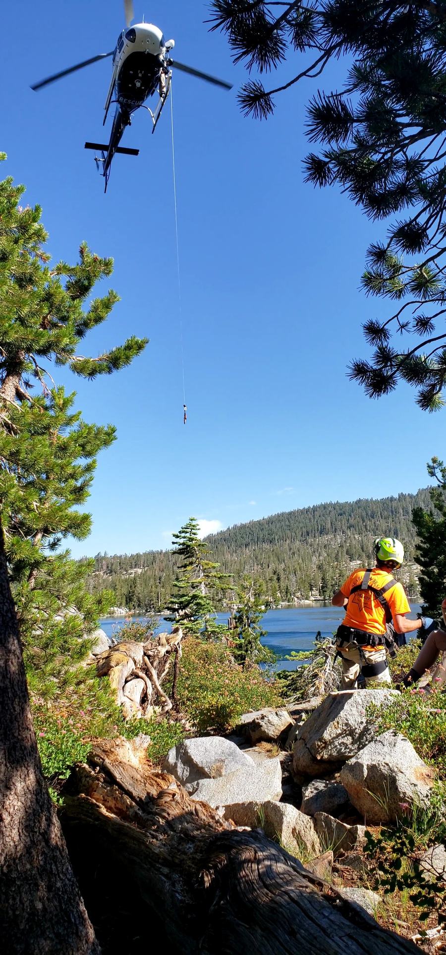
From the morning of the extraction. It became a full ordeal — but it worked.
It took most of the morning to turn fear into a plan that worked. We split the effort. One person started hiking out fast to raise the alarm at the trailhead the old-fashioned way — on foot, on the clock. And then someone remembered, or guessed, that we might be able to scrape together a bar or two of cell signal from the top of a ridge not far from camp. Knowing the terrain — knowing exactly where we were and where that high ground sat — turned out to matter enormously. We climbed to the ridge, and there it was: just enough signal to get a call out.
From that ridgeline we got through to local emergency response and started coordinating an extraction. Where exactly we were. How to reach us. His condition, his history, the terrain a rescue team would have to cross. It became a genuine ordeal — the kind of long, tense, all-hands effort you hope you never have to be part of. But it worked. We got our friend out of the backcountry and into the care he needed, and he survived. I don't say that lightly. There's a version of that night that ends very differently, and the only thing standing between us and that version was a lucky ridge with a sliver of signal.
The lesson Never be unable to call for help
Every other lesson in these stories cost me a cold night, a burned lip, a few anxious hours of being lost. This one could have cost a life. The difference between a story you tell later and a tragedy can come down to whether anyone in the group can reach the outside world — and on that trip, the answer was almost no.
I never go into the backcountry without a way to call for help anymore. Today an iPhone can send emergency messages over satellite, and that's a genuinely good safety net to have in your pocket. But I still carry a dedicated satellite device — a proper beacon — every single trip, because when it's someone's life on the line I want a tool built for exactly that and nothing else. A way to call for help is the one piece of gear you never, ever borrow and hope for the best on.
Backpackers Friend can't make that call for you — carry a beacon, please. What it can do is the part that saved us that morning: it keeps a full topo map and your exact position on your screen with no signal at all, so you always know precisely where you are, what the terrain around you looks like, and where the nearest high ground is when you need to find a sliver of coverage. When you have to tell a rescuer where to come, “I'm not sure” is the worst possible answer. Knowing exactly where you are is the first thing that goes right in an emergency.
Know exactly where you are
Backpackers Friend lets you build a route on a topo map before you leave home — waypoints, trail-snapped navigation, and elevation profile included. It works completely offline, so your position and the terrain around you stay on screen with no signal. Pair it with a satellite beacon and you're ready for the day that doesn't go to plan. Free to get started, no account required.
Download free on the App Store