Twenty-two first-person backpacking trip reports written by Gabe Mullen,
who walked every one of them and built the Backpackers Friend app along the way.
They cover a 162-mile Tahoe Rim Trail thru-hike in July 2026,
four trips into Desolation Wilderness between 2012 and 2021,
the Lost Coast Trail in the King Range, three overnights at
Coast Camp in Point Reyes National Seashore, two nights at
Rancheria Falls above Hetch Hetchy in Yosemite, a turned-around
solo above Chilnualna Falls in Wawona, an overnight at
Young Lakes above Tuolumne Meadows, a cross-country shortcut and a
burn scar out of Ostrander Lake toward Buena Vista, three days
among the lakes of the Ansel Adams Wilderness, and a family
trip to Milk Lake in Tahoe National Forest, all in California and
Nevada.
Each one is a field account rather than a guide, recording what the water sources actually
held, what the weather actually did, how far we actually got, and what the trip cost.
Dates matter here, because a conditions report is a snapshot of one trail in one week,
and every story below is labeled with when the trip happened and when the page was
published. The Tahoe Rim
Trail series is best read in order.
The trips at a glance
Every trip on this page, with where it happened, when, and how far.
Ediza, Garnet, and Thousand Island Lakes, Ansel Adams Wilderness, CA
September 2024
2 nights; about 28 miles from Agnew Meadows
Quick answers from these trips
The questions people ask most often about these trails, answered from what we found on
the ground. Every answer links to the full report it comes from. Conditions answers
describe a specific week, so check the date before you rely on one.
Is there snow on the Tahoe Rim Trail in July?
In mid-July 2026 there was no snow on the trail anywhere on the 165-mile loop, and
nothing that called for traction, meaning no ice axe and no spikes. The only snow in sight
was one small patch near Relay Peak and a few cosmetic patches on the north faces of
Freel Peak, all well off the tread. A June start in a big snow year is a different
question. Full conditions report →
What is the longest dry stretch on the Tahoe Rim Trail?
Spooner Summit to Kingsbury runs nearly 20 miles without a reliable source, which is the
longest dry carry on the loop. We loaded six liters each at Spooner and dry-camped on
the ridge. Star Lake to Big Meadow is a second thin stretch of about 13 miles. The
pattern holds all the way around, since the west side, the south, and Desolation Wilderness
are soaking wet, and the Carson Range on the east and north makes you carry every liter.
Source-by-source water list →
How long does it take to thru-hike the Tahoe Rim Trail?
Thirteen days on this trip: 162 miles clockwise from Brockway Summit back to Brockway
Summit, about 33,450 feet of climbing, between 6,234 and 10,220 feet of elevation.
Clockwise front-loads the big Carson Range climbs and saves Desolation Wilderness, the
scenic payoff, for the back half.
How the loop broke down →
Can you resupply on the Tahoe Rim Trail?
Easily, since the TRT is one of the friendlier long loops in the country. The trail crosses
paved roads at Brockway, Mt. Rose, Spooner (Highway 50), Kingsbury, Echo, and Tahoe
City. The Tramway market at Kingsbury held our box and takes UPS or FedEx, not
USPS. The Echo Lake Chalet sells freeze-dried meals but accepts no mailed
packages. Logistics in detail →
What is the weather like on the Tahoe Rim Trail in July?
Highs around 78°F, overnight lows around 52°F, and no wildfire smoke in July
2026, and the summer monsoon rhythm was in full effect, with clear warm mornings
building to real afternoon thunderstorms. Get the exposed high points done early. We
shifted to 5:00 to 6:00 a.m. starts and were over the day's ridges before noon.
The storm we saw coming →
Is the Echo Lake water taxi worth taking?
Yes. $25, shortcuts about two miles across the lake, and it's honestly just fun. The
Echo Chalet and the boat both open at 9 a.m., so time your arrival if you want the
ride. Leg 3, from Echo into Desolation →
Are there mosquitoes on the Tahoe Rim Trail?
Mild in July 2026. The Nevada side through the Carson Range was nearly bug-free.
Mosquitoes turned up in real numbers on the wetter ground of Meiss Country and Big
Meadow, worst at dusk, and we never needed a head net, since camping on drier
ridges rather than at the meadow edge solved most of the problem.
Conditions report →
How many calories do you burn backpacking each day?
Nearly 5,000 a day across this thirteen-day thru-hike, about 64,300 for the whole
trip, against roughly 1,600 eaten per day, ending 13 pounds lighter. That gap is
the whole argument for fueling rather than dieting on a long trip, because the deficit
degrades judgment and pace well before the loss shows up on a scale.
The numbers, in full →
Do mountain bikes share the Tahoe Rim Trail?
On the east rim, yes, and bikes are allowed there on even-numbered calendar days.
Hiking the east side on an even day, expect to step aside for riders. The tread is
graded for both, which is part of why the east side walks so smoothly.
Leg 1, down the east rim →
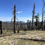
Does the Tahoe Rim Trail pass through a burn scar?
Yes, through the older Caldor Fire footprint around Echo Summit. There is little to no
shade, so the ground bakes in the afternoon, and standing dead trees are worth thinking
about when you pick a stopping place on a windy day. Camping is restricted from Highway
50 to the Desolation boundary, so find a legal site in advance, and Nebelhorn is one
option.
Fire scars section →
Tahoe Rim Trail 2026, the thru-hike in order
162 miles around Lake Tahoe in thirteen days, July 2026, clockwise from Brockway Summit.
Start with the conditions report, then walk the four legs.
Why I built this, and the trips behind the features
Fourteen earlier trips, from a first fumbling night in Desolation Wilderness in 2012 to a
ridge of loose scree above Iceberg Lake in September 2024. Each one caused something in the app.
 Backpackers Friend