
The Tahoe Rim Trail Right Now (July 2026)
The trip started with a beer at Urban Roots. A friend and I were talking through backpacking plans for the next year, and I floated the whole Tahoe Rim Trail as a thru-hike. She countered with doing the trail in sections instead, since two weeks felt like a lot to ask of anyone's calendar. But the idea kept gathering momentum right there at the table, until she looked at me and signed on for the whole loop. Two days ago I finished walking the loop for real, 162 miles on my own two feet, thirteen days, one clockwise circle from Brockway Summit all the way back to my car. This is the report I wish someone had handed me before I left, covering what the trail is truly like right now, mile for mile, while the whole walk is still fresh enough that my socks aren't yet dry.
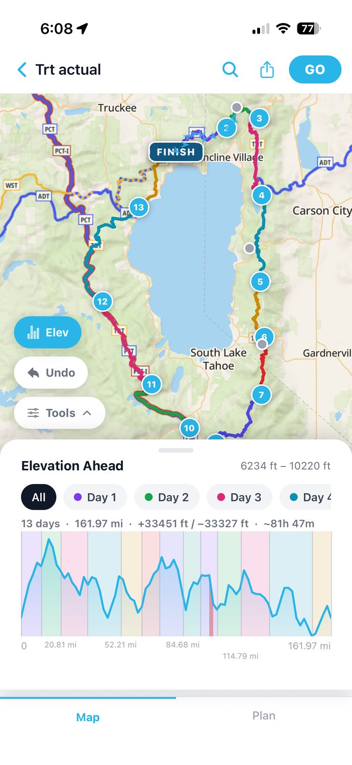
The actual route and elevation, straight from the app, covering 13 days and 161.97 miles between 6,234 and 10,220 feet, with about 33,450 feet of climbing.
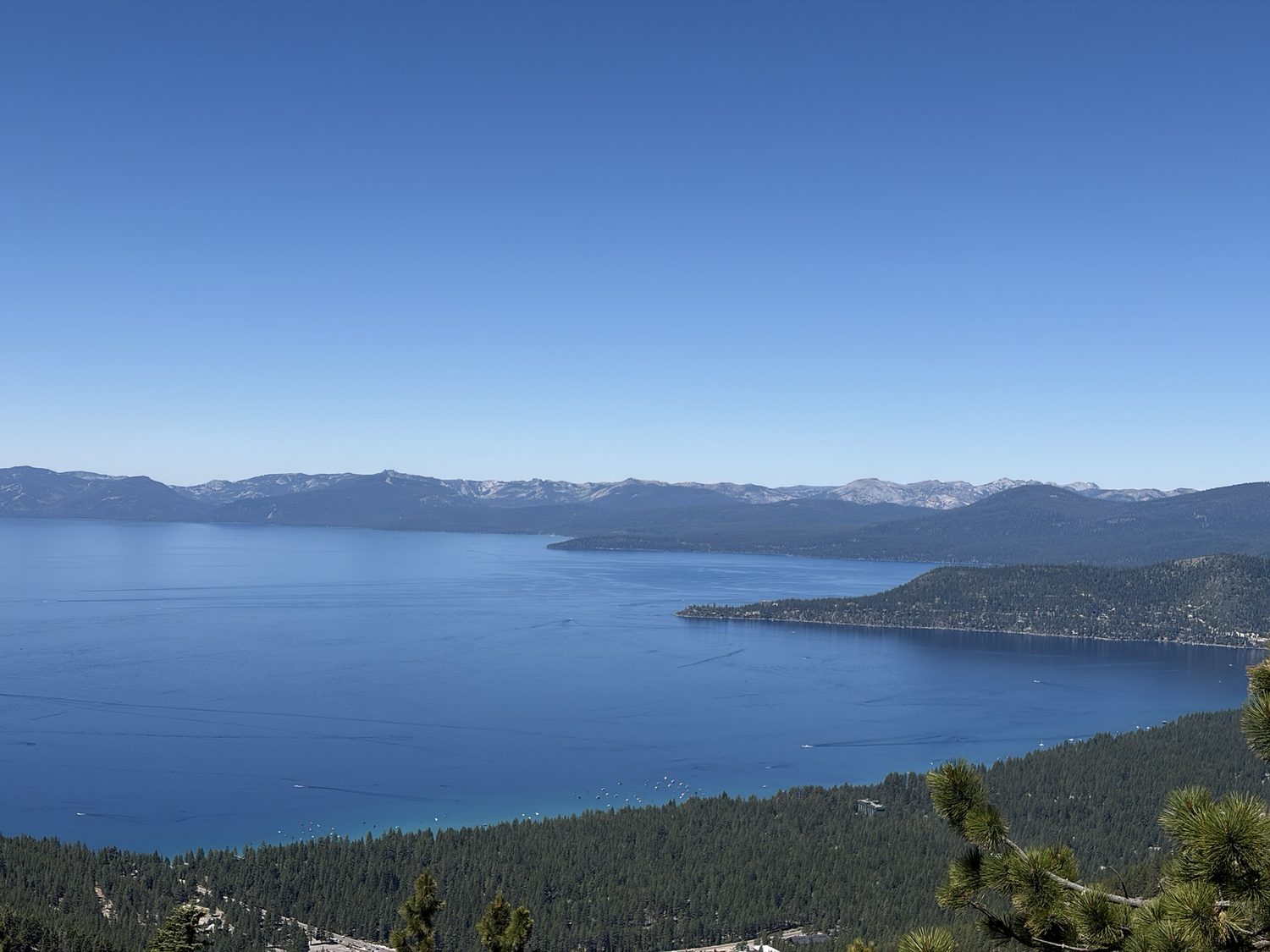
The east rim above Incline Village. For most of 165 miles, that water is the one landmark you never lose.
The TRT is a 165-mile loop that rings Lake Tahoe like a crown, with Sierra Nevada granite on the west, the drier, piney Carson Range on the east, and that impossible blue water below you nearly the whole way around. We went clockwise from Brockway Summit on the north shore, which front-loads the big Carson Range climbs and saves Desolation Wilderness, the scenic payoff, for the back half. Everything below is what we found in the second week of July 2026. Trails change, so read the date at the top of this page and check the Tahoe Rim Trail Association's current conditions page before you commit.
Snow None to speak of
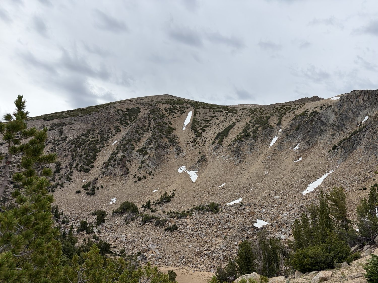
The Freel massif, the trail's high shoulder. This patch and one small patch near Relay Peak were the only snow we saw the whole loop, and both lay well off the tread.
There was no snow on the trail anywhere on the loop, and nothing that called for traction. We never wanted an ice axe or spikes, and we were glad we didn't carry either. The only snow in sight the entire trip was a small patch near Relay Peak and a handful of cosmetic patches clinging to the north faces of Freel Peak, none of them anywhere near the tread. If you're eyeing a June start in a big snow year the answer changes, and by the second week of July in a normal year the high country is completely clear.
Water The one hard variable
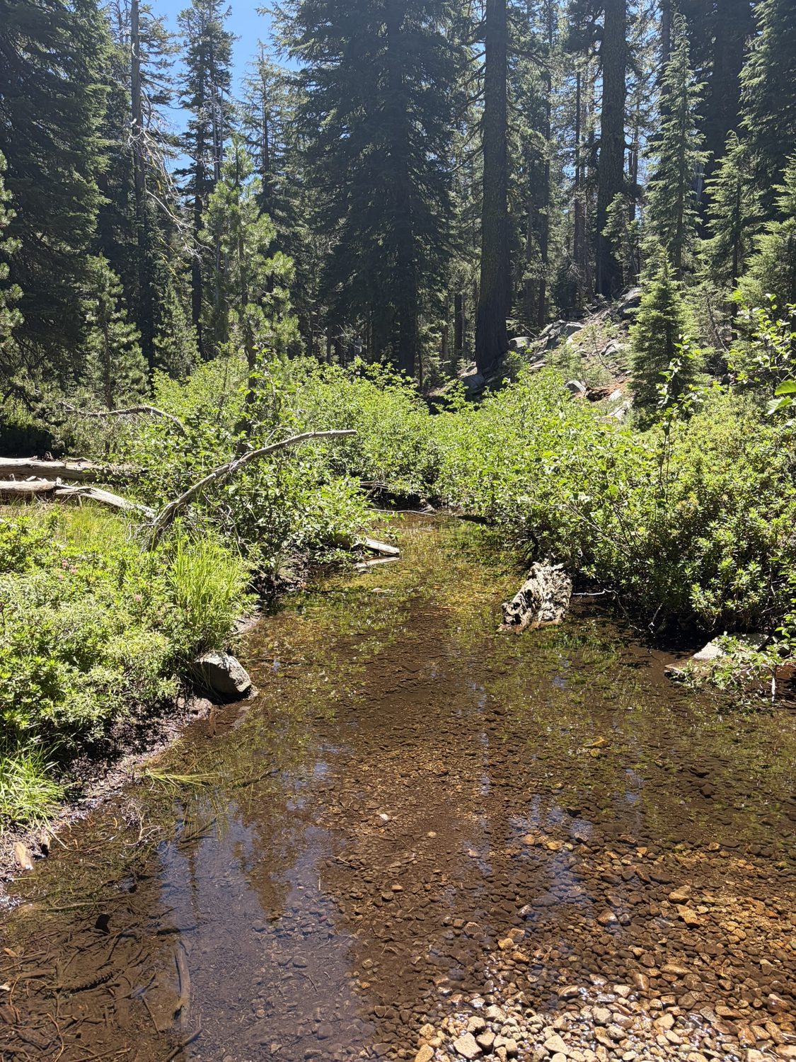
Phipps Creek, on the trail's wetter west side. The TRTA lists the creek as seasonal, but as of July 20 the water was still flowing slowly, easy to get, and delicious.
Water is the single biggest planning variable on this trail, and the supply is wildly uneven. The west, south, and Desolation Wilderness are soaking wet, with creeks and lakes and springs offering more than you can drink. The Carson Range east and north are the opposite, being dry and exposed and hot, with real gaps between reliable sources. The stretch that demands respect is the Spooner-to-Kingsbury carry, which runs nearly 20 miles and is the longest dry stretch on the loop. The Tahoe Rim Trail Association publishes the standing list of sources, which is the right place to start planning. We found the following this July, in trail order clockwise from Brockway.
- Gray Lake (Day 1 camp, past Brockway) was full and good, with a couple of streams flowing just before the lake.
- Galena Falls, below Relay Peak, had plenty.
- Mt. Rose Campground has potable water on tap.
- Ophir Creek, plus a creek about two miles farther on, were both flowing.
- Twin Lakes, a TRTA-listed seasonal source just before Marlette Campground, was completely dry.
- Marlette Campground has a well. A sign warns of “elevated aluminum,” but nothing was noticeable and I drank the water with no problem.
- Spooner Lake is worth skipping. The water was scummy and receding, and we'd meant to filter some and didn't. There's a reliable well on the west side, at a cost of an extra 1.5 miles or so.
- Spooner to Kingsbury is the crux at nearly 20 dry miles. We loaded 6 liters each at Spooner and dry-camped on the ridge. Plan this carry deliberately.
- Kingsbury to Star Lake had a couple of streams flowing on the climb, and Star Lake itself was full and excellent, and a superb camp besides.
- Star Lake to Big Meadow runs about 13 miles without much water, though the options increase as you near Luther Pass.
- Big Meadow, Round Lake, and Showers Lake were all reliable and plentiful.
- Audrain Lake (near Echo) was algae-choked along the shore. We skipped the lake and filled instead from the excellent South Fork American River beside the highway.
- Desolation Wilderness, meaning Aloha and the Velmas and Gilmore, was wet and wonderful the whole way. There is water everywhere.
- Phipps Creek is listed by the TRTA as seasonal too, but as of July 20 the creek was still flowing slowly, and the water was easy to get and delicious.
- Bear Creek, past Richardson Lake, was flowing.
- Ward Creek is a little tough to get down to, and the creek was flowing, with good camping nearby.
- Tahoe City to Brockway (the final 19 miles or so) is hot and exposed, and the trailhead sign's warning that “water is scarce” is fair, though the stretch is not entirely dry. Watson Creek, near Watson Lake, was flowing well, and I dumped the water I'd carried from the motel and refilled there instead. Top off in town regardless and treat Watson Creek as a bonus rather than a guarantee.
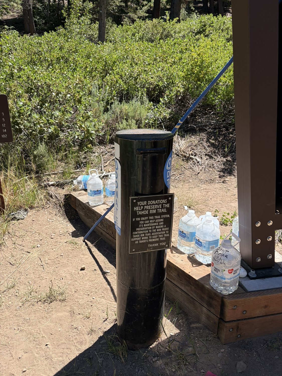
A water cache at a road crossing near Spooner, clearly the work of trail angels, with some jugs marked with names and dates. We didn't take any, since the cache looked like someone's personal stash, though we noticed other hikers had helped themselves anyway. Treat a cache as a kindness rather than a plan, because the jugs may not be there and may not be meant for you.
The pattern is simple once you see the shape of the loop. The west, south, and Desolation drown you in water, and the Carson Range east and north make you carry every liter. We filtered everywhere, and marked every source as a waypoint before we left, so we always knew exactly how far the next drink was rather than hoping. On a dry ridge in the heat, that knowledge is the whole game.
Weather Sun all morning, thunderstorms by afternoon
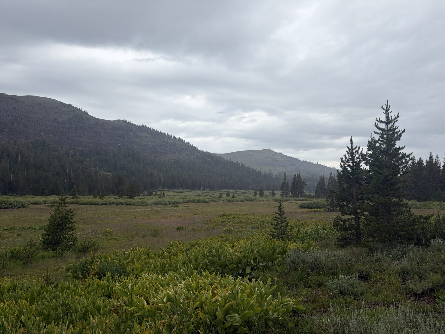
Meiss Country, early afternoon. Blue sky at breakfast; this by two o'clock. This was the pattern most days of the second week.
Temperatures were close to ideal, with daytime highs around 78°F and overnight lows around 52°F, and we had no wildfire smoke or haze the entire trip, only clean Sierra air and long blue views. But the classic summer monsoon rhythm was in full effect, bringing clear warm mornings that built to towering afternoon clouds and genuine thunderstorms. One afternoon over Meiss Meadow the forecast simply read "60°, Thunderstorm," and the sky delivered. The lesson the trail teaches over and over is to get your miles and your exposed high points done early. We started leaning on 5:00 to 6:00 a.m. wake-ups by the second week, were usually over the day's ridges before noon, and let the storms have the afternoons. Do not be the high point on Relay Peak or the Freel traverse at 2 p.m. Carry rain gear you actually trust, because you may well need the gear.
Bugs Present near water, tolerable moving
Mosquitoes were a non-issue on the Nevada side, and the Carson Range stayed nearly bug-free the whole way. That changed once we crossed into Meiss Country and Big Meadow, where the wetter ground brought them out in real numbers and they grew hard to ignore, especially at dusk. Even so, we never needed a head net, and long sleeves and a little patience were enough. If you're bug-averse, camp on the drier ridges and breezy benches rather than right on the meadow edge, and you'll sleep fine.
Fire scars The Caldor burn near Echo
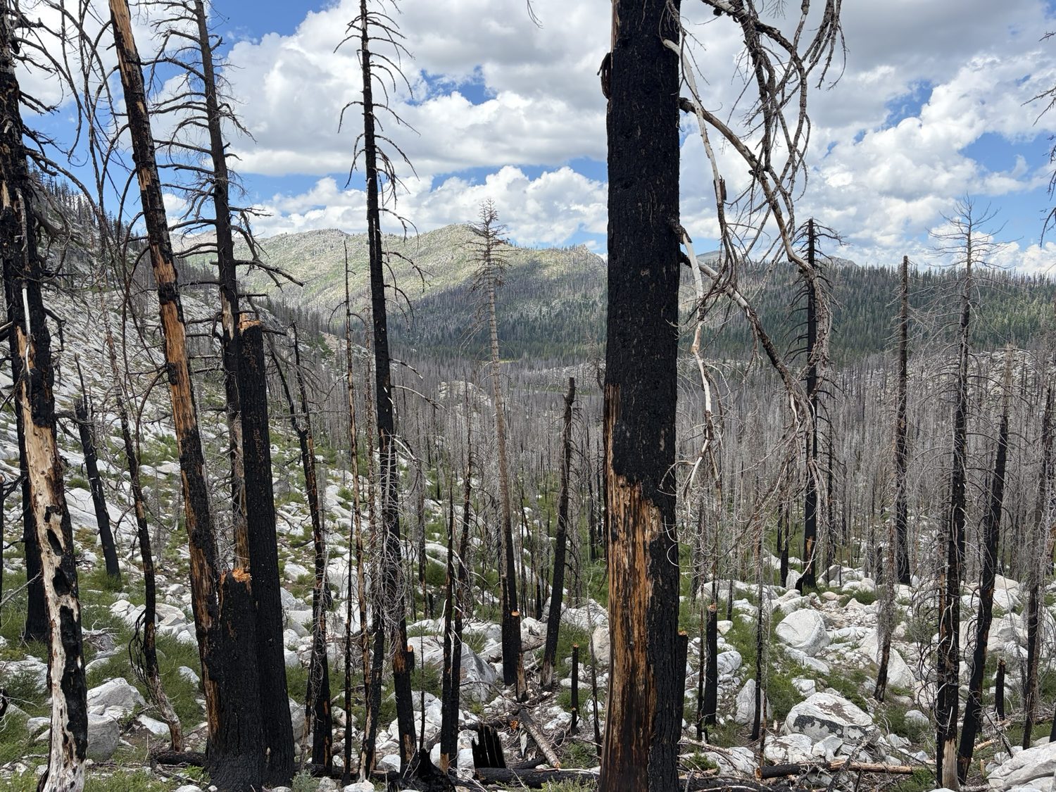
The Caldor burn above Echo. Standing snags, no canopy, and a floor of green coming back underneath.
To be clear, we had no active fire and no smoke anywhere on the loop this July, and the air was clean the whole way. But the trail does pass through the older Caldor Fire footprint around Echo Summit, and that scar changes the walk in two concrete ways. There is little to no shade through the burn, so the ground bakes in the afternoon, and standing dead trees mean you should be thoughtful about where you camp and stop on a windy day. The burn is not ugly, since the understory is coming back green and thick, and the burn is exposed. Push through in the cool of the morning and save your long breaks for the living forest on either side. Camping is also restricted through here, from Highway 50 all the way to the Desolation boundary, so you can't just stop wherever your legs give out. If you're hunting for a legal spot in this stretch, look toward Nebelhorn as an option. The South Fork of the American River, right beside the highway, was flowing well the whole time we were there.
Permits New for 2026: the TRT thru-hiker zone
The biggest change on this trail this year is on a website rather than in the dirt. Desolation Wilderness now has an overnight quota zone that exists only for people walking the entire Tahoe Rim Trail. The zone is numbered 46 and named for the trail, and the zone went live on Recreation.gov on March 20, 2026. If you're thru-hiking the loop, this is the permit you need, and there are only ten spaces a night. The permit is a genuine gate on the trip. Sort the permit before you sort anything else. The Tahoe Rim Trail Association keeps a full rundown of permits and regulations for every jurisdiction the loop crosses, which is worth reading alongside the Desolation booking.
- Zone 46 is for full-loop thru-hikers only, booked through the Desolation Wilderness permit on Recreation.gov. Section hikers use the regular 45 destination zones instead.
- Ten spaces per night, and the season's permits released in one batch on March 20 at 9 a.m. Pacific rather than on a rolling window.
- Two nights maximum inside Desolation while traveling the TRT/PCT corridor. That cap shapes your whole mid-trip schedule.
- Camp within 300 feet of the corridor, and pick your entry point when you book. Choose Echo Lakes if you're going clockwise and Richardson if you're going counterclockwise.
- No camping at or around Lake Aloha. Aloha is the spot you'll most want at the end of that day, and Aloha is off the table.
- You can only print the permit 14 days out, and that limit nearly beat us. We saved Desolation for the back end of the loop, so our entry date fell deep into a thirteen-day walk, and the print window opened only a few days before we drove to the trailhead. On a longer trip, or with Desolation placed any later in one, I would have been out walking before the permit was printable at all.
- You also need a California Campfire Permit, which is free at readyforwildfire.org, to run a gas or liquid-fuel stove. On this trail that means everyone.
You have to name your Desolation dates up front. Months before you leave, on a thirteen-day walk, you are committing to exactly which calendar nights you'll be inside that wilderness, and you commit before you know your pace, the weather, or how your feet are going to hold up. Two nights is enough to cross the corridor comfortably. Two nights is not enough to absorb a mistake. If you run a day fast or a day slow, the permit doesn't move with you.
That squeeze lands hardest on a clockwise loop like ours, because clockwise you come at Desolation from the south, and the approach is the worst place on the entire trail to be off schedule. Camping is restricted the whole way from Highway 50 to the Desolation boundary, so if you arrive a day early there is no legal place to sit and wait. What's behind you isn't a good place to wait either. Behind you is the Caldor burn, with no canopy and no shade, and Audrain Lake sits in the middle of the burn algae-choked and not worth filtering. You can't comfortably stall short of the boundary and you can't legally camp in the gap, so you have to walk into Desolation on the day you told the government you would. This was the one stretch of the loop where my partner and I genuinely disagreed about the plan.
So build your slack somewhere else. Put the flexible days out in the Carson Range, where camping is unrestricted and nobody is counting you, and treat your permitted Desolation entry date as the fixed point the rest of the itinerary bends around. The squeeze is also a fair argument for walking the loop counterclockwise, because counterclockwise brings Desolation up in your first few days, while you're still close to the schedule you planned, instead of late in the walk with a week and a half of drift piled up behind you.
Trail surface & logistics Well-signed, well-graded, easy to resupply
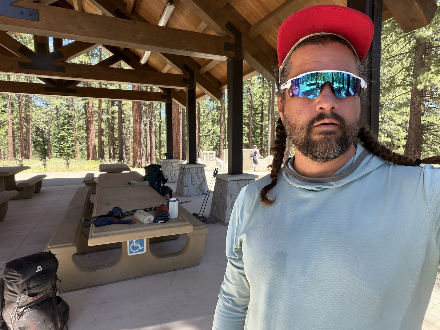
The Spooner Summit shelter, one of the shaded, road-crossing rest stops that make this loop so forgiving. We refilled, dried out, and loaded up here for the long dry carry to Kingsbury.
The tread itself is a joy, graded for both hikers and mountain bikers over much of the east side, generally smooth, with only a few talus traverses and one or two rocky descents to slow you down. Signage is excellent, and the blue TRT blaze and the shared PCT markers through the Meiss and Desolation sections kept us on route the whole way. That tread and those signs are maintained by Tahoe Rim Trail Association volunteer crews, and the quality of their work shows across all 165 miles. Logistically this is one of the friendliest long loops in the country, because the trail crosses paved roads at Brockway, Mt. Rose, Spooner (Hwy 50), Kingsbury, Echo, and Tahoe City, so you can resupply and even sleep in a bed without ever leaving the trail's momentum. We split thirteen days into three legs around those road crossings, and the split made a big trip feel like a series of manageable ones.
A few specifics matter before you go.
- Mountain bikes, east side, even days. The east-rim tread is shared with bikes, which are allowed there on even-numbered calendar days. Hiking the east rim on an even day, expect to step aside for riders.
- Resupply. The Tramway market at Kingsbury held our box, and they take UPS or FedEx, not USPS. The Echo Lake Chalet sells freeze-dried meals if you want to top up there, but does not accept mailed packages.
- Echo Lake water taxi. The ride costs $25, saves about two miles of walking along the lake, and is honestly just fun. Take the boat. The Echo Chalet and the boat both open at 9 a.m., so plan your arrival accordingly if you want the ride.
- Parking at Brockway Summit. We left the car right at the Brockway Summit Trailhead itself for the full thirteen days, no issues. There's also an upper lot just north of the highway, signed “Overnight Parking OK,” which is a good option if you'd rather have the officially designated spot.
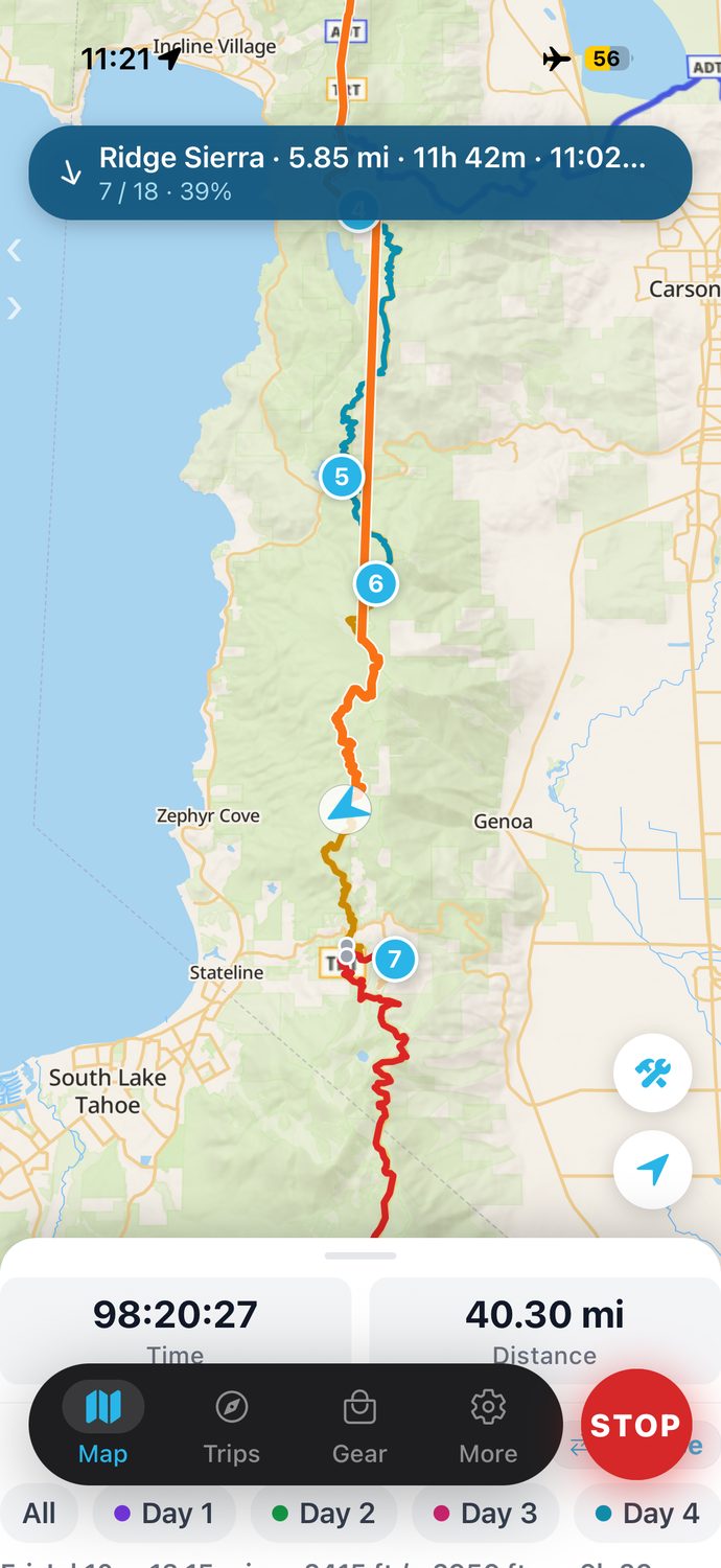
Day four on the east rim, tracking in the app I built for exactly this trip, with each day a different color, 40 miles in, and the phone in airplane mode the whole time. Everything on this page, I lived and logged out there.
I built this app from a trip I only imagined. Then I walked the real loop to see if I'd gotten the app right.
The loop, in four legs
This report is the front door to the full story of the walk. I've broken the trip into the same four legs we hiked, and each leg runs trailhead to trailhead with a separate weather pattern and a separate character. Read them in order and you'll walk the whole loop at our side.
Plan your own loop, then walk the loop
Everything in this report, I planned and tracked in Backpackers Friend. Every water source and campsite went in as a waypoint, the route snapped to the real trail, and thirteen days logged day by day with the phone in airplane mode the whole time. Build your route on a topo map before you leave, download the map for offline use, and let the app watch your line while you walk. Planning a trip is free and needs no account.
